In December I launched my first android app! The past two months I’ve been working on designing the site, to make it look just like the android app.
So, what is this all about?
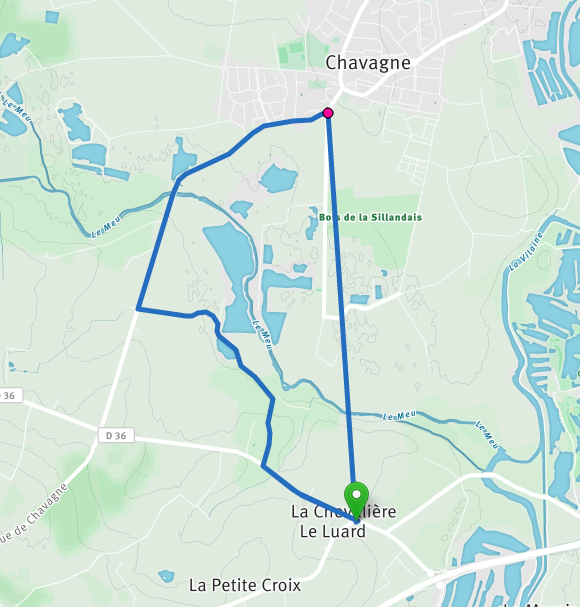
MyRoutes is a routeplanning tool for hikers, runners, cyclists, who want to follow their own specific path on a more detailed map. The app tracks the total distance of the route and you can follow your location on the drawn out path. To create your own routes, tap anywhere on the map and the track will be built.
It has build in functionality to send routes to your app. Its also multi directional, you can create routes on the app and send it to the site.
Where am I heading with this app?
MyRoutes will focus solely on routeplanning, not on livetracking (there are enough solutions for this). Im trying to build an interactive map that will show all the routes in your neighborhood and worldwide. Im also exploring options to support running/cycling events with showing their routes and adding custom icons for it.
Nice app @fullhdpixel, congratulations !
(OSX10.12.3 FF 52.0.1) I had a little bug, after setting my start marker, I double-clicked (instead for single click) for the next marker : it draws the route between the first and second marker but also add a direct straight line between the second and first marker ! If I single click again it add a third marker with route from the second marker as expected. Any further double click draws a line between the current and previous marker.
A little suggestion. When a button has an action that is not immediately obvious (because maybe it doesn’t have anything to work on when pressed), perhaps disable it, or add more explanations in the tooltip. Such is the case of ‘Snap to road network’ (ON/OFF). I tried and it does nothing either way, with or without a route drawn.
I’m curious, where do you get your base tiles from? Mind you, each provider that I know of and which I think I could recognise (e.g. OSM, MapQuest, Stamen) has very clear attribution requirements. Attribution is mandatory and should always be displayed. Example: https://www.mapbox.com/help/attribution/
@illustreets, thanks you’re right about the attribution. I’ll implement this asap.
Base tiles are OpenStreet & Lyrk, Or do you mean Google maps inside the android app? That’s just default when implementing a Google Mapsactivity. The other maptiles are coming from mapbox.
About the snap to road button, it only works for new paths being drawn. So you toggle it whenever you want to draw a straight line. For new users this can be tricky, so maybe I should show them the option to walk through a quick and easy tutorial.